 A big hello to all six of our followers and anyone who is reading this! As you can see from the above image featuring fellow Texas Tech V2 participants Sarah Dillingham and soon to be Dr. Ian Giammanco, we have had an uneventful first day of the project. That does not mean it has been an uneventful weather day as severe thunderstorms and tornadoes have unfortunately effected portions of Arkansas, Mississippi, and Tennessee. Our hearts go out to everyone effected by today's weather and it's natural to wonder why VORTEX2 wasn't out to collect data on these storms. The first reason is purely practical, it wasn't logistically possible to get from Lubbock, Texas to eastern Arkansas in a single day to be in the proper position. The second reason requires that we draw a distinction between simply seeing tornadoes and collecting meaningful data on tornadoes, which also lends itself to a discussion on the role of the TTUKa mobile Doppler radars that I will be working with this year. I'll try to outline the distinction below:
One of the primary research thrusts of the "tornado-scale" radars participating in V2, which consist of the two TTU Ka-band radars, the Rapid-Scan Doppler on Wheels, and the UMASS W-Band radar, is to collect multiple-Doppler datasets of tornadoes (and hopefully tornadogenesis) very near the ground. This region, known as the "corner-flow" region is where strong inflow into the vortex is tilted into the vertical to ascend within the tornado. Very few observations have been made of the corner-flow region and to the best of my knowledge, no dual-Doppler datasets of the region exist. As the majority of people inhabit the same near-ground region, a better understanding of the corner-flow region will hopefully lead to a better understanding of how tornadoes produce damage and to safer building designs.
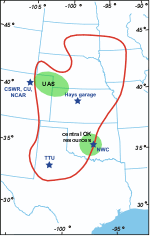
That said, there is a reason very few datasets of the low-level tornado vortex structure exist. In order to obtain the desired measurements, multiple high-resolution Doppler radars need to be properly placed in positions very close to the tornado with nothing obstructing their view such as trees, buildings, or terrain features, and they also need to have little or no precipitation falling between their position and the tornado. The reason for these requirements involves the tradeoffs necessary to make when designing a Doppler radar. The tornado-scale radars have sacrificed the ability to scan over long distances and through heavy precipitation in order to have very high spatial resolution and a greater sensitivity to make accurate velocity measurements. Therefore, to maximize our chances of getting an unobstructed view of the tornado with the Doppler radars (and to keep wind measurements from surface observing equipment such as StickNet from being influenced by vegetation and terrain) V2 will primarily target storms that form in very flat regions with few trees (http://www.eol.ucar.edu/projects/vortex2/images/v2_domain_70dpi.gif).
It's a pretty tall order to get an unprecedented dataset, but we should get several chances over the coming weeks and hopefully we can nail a few events. I'll be here to post the summary once we do!
No comments:
Post a Comment